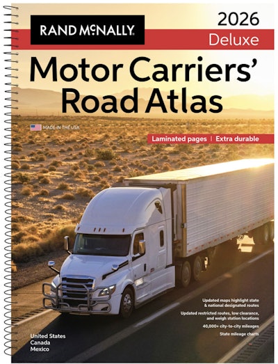
One of the most essential items for truckers’ toolkit has been updated to include the latest information to help truckers get where they’re going.

The new editions of the atlas are available in paperback; a spiral-bound, laminated Deluxe version; and a Large-Scale edition with maps that are 37% larger. All are available at randpublishing.com, travel centers, e-commerce outlets, and bookstores.
Along with updated maps, the atlas is valued for its detailed front-section listings, which include:
- Fuel tax information
- Tractor-trailer inspection procedures
- Hazmat route regulations
- Updated restricted routes and low clearances
- Weigh station locations
- Mileage directory
- State and national route coverage
For the 2026 edition, road-specific updates include:
- Interstate 42: Added portions of new interstate to the North Carolina map
- Highway 540: Added a new section of the toll road in North Carolina south of Raleigh
- State Highways 8 & 15 and Interstates 291 & 384 in Connecticut: Updated to reflect mileage-based exit numbers
- U.S. Highway 169: Upgraded portion of highway to limited access northwest of Minneapolis
- Interstate 344: New designation added to the Oklahoma City map
- TN 690: New limited access section opened on bypass around Union City
[Related: Ways to assess truck market value for purchase, trade or sale, insurance purposes]


